Saturday, February 25, 2012

La Paz y El Camino de la Muerte / La Paz and the WMDR (World's Most Dangerous Road)

--- for English, scroll down ---

Otra vez tengo que empezar con un anuncio técnico: como el problema con las fotos ya está resuelto, cambié todas las fotos en los posts anteriores para unas que tomé yo durante el viaje - si queréis, podéis checkearlos.

En Bolivia, la primera intención era visitar el desierto de Salar de Uyuni. Desafortunadamente, como había tanta lluvia y tantos problemas en la carretera, eso no funcionó y todas las agencias nos dijeron que no es una buena idea ir allí en estos días. Así me quedé en La Paz que como ciudad ni es super interesante ni organizada y las posibilidades son bastante limitadas. Su altitud es algún 3.600 metros y eso se siente cuando estás caminando en sus calles muy empinadas.

Vista de La Paz con Pico Illimani (6438 m) escondido en los nubes
Así teníamos que reorganizarnos y decidimos que vamos a hacer el famoso ruta ciclista El Camino de la Muerte. El nombre normal de esta ruta es el Camino a Los Yungas y es un camino más o menos de 80 kilómetros que une La Paz con la región de Los Yungas al noreste.

El camino es de triste fama porque históricamente tenía las peores estadísticas en tema de accidentes mortales. Eso no es una gran sorpresa cuando sabemos que es de un ancho de un sólo carril (3 m en algunos lugares), no hay guardarraíles en ningunas partes y en la zona son habituales la lluvia y la niebla. El 24 de julio de 1983, un bus se desbarrancó precipitándose en un cañón, produciendo la muerte de más de cien pasajeros en el peor accidente vial de Bolivia.

El Camino de la Muerte - antes de empezar
Estos días, el transporte pasa en otra carretera más nueva y moderna y la gran mayoría de la gente que pasa por aquí viene en otro tipo de transporte: en bici.


El problema es que en Bolivia, hay otro deporte nacional y no es el fútbol: es hacer bloqueos. Cuando el precio del petroleo sube, hacen un bloqueo. Cuando el transporte público no pasa en el barrio, hacen un bloqueo, etc. Cuando empezamos el primer día, estábamos bloqueado durante más de tres horas por un bloqueo y nos dijeron que van a quitarlo. En el cuarto hora, nos dijeron que no van a hacerlo... Así teníamos que volver a la ciudad con mucha frustración (y volviendo, teníamos que dar una vuelta muy grande por culpa de un bloqueo que formaron atrás de nosotros mientras tanto). Finalmente, solamente pudimos hacer el tour el día siguiente.

Normalmente, los tours empiezan en la altitud de 4.700 metros y se puede bajar más de 3.000 metros hasta la ciudad de Yolosa. En nuestro caso, nevaba tanto y hacía tanto frío que nuestro guía sugirió que empezamos solamente en la boca del camino antiguo. Todo el mundo estaba de acuerdo.

Ciclista en el Camino
Antes de hacerlo, pensaba que El Camino es algo realmente difícil y peligroso. En realidad, no es así. Si no haces cosas locas y no te vas con velocidad extrema, no va pasar nada y vas a disfrutarlo muchísimo porque las vistas son realmente impresionantes. Hacerlo en la época de lluvia también significa que se ve un montonazo de cascadas e incluso, hay que pasar de vez en cuando abajo de ellas que te da una ducha bien fría.

De verdad, probablemente El Camino habría dado mucho más miedo en bus.

Como todavía me quedan unos días, decidí que la última etapa de mi viaje será un intento para ir al cumbre de Huayna Potosí (6088 m) cerca de La Paz.
-------------------------------------------------------------------------------------------------------------

Once again, I have to start with a technical announcement: since the virus problem with the photos is now resolved for once and all, I've changed back all the photos in the former posts to ones which I have taken during my trip - check them out if you feel like it.

In Bolivia, my first intention was to visit the desert of Salar de Uyuni. Unfortunately, since it was very rainy and there were loads of problems on the road, it did not work out and all the tourist agencies were advising against going there these days. So this was how I stayed in La Paz which is neither a super interesting nor a super organized city and the possibilities are rather limited. Its altitude of 3.600 meters also makes you feel it when you're walking on its really steep streets. 

So we had to reorganize and we decided that we'll do the famous bike ride of The Death Road. Its normal name is The Yungas Road and it is a 80-kilometer long route which connects La Paz with the region Yungas in the northeast.

It has its bad reputation due to its historically bad statistics in terms of mortal accidents. It is not a big surprise if we think about the fact that it's a one-lane road which is only 3 meters wide at certain points, the are no barriers and the area has a lot of rain and fog. On 24 July 1983, a bus tipped over the edge and fell in the canyon, killing all the 100+ passengers aboard in the worst road accident of Bolivian history.

These days, road traffic does not pass here anymore as they have a connection which is newer and safer. The vast majority of people come here now by other means: by bike.


The problem is that in Bolivia, there is another national sport which is not football: making roadblocks. The price of petrol went up? Let's make a roadblock! Public transport does not cross our neighbourhood? Let's make a roadblock! And so on. When we started off the first day, we came to a stall at a certain point and had to stay there for more than three hours. It was due to a roadblock which we were informed is going to be lifted. In the fourth hour, we were informed that this is not gonna be the case. So totally frustrated, we had to go back to the city without doing anything - and on the way back, we had to make a massive detour due to a roadblock which they spontaneously formed behind us while we were waiting... Finally, we could only do the tour the next day.

Normally, the tours start at 4.700 meters of altitude and you descend more than 3.000 meters to the city of Yolosa. In our case, it was snowing so much and it was so cold that our guide suggested to start only at the beginning of the old (the "classic") road. There was no opposition.

Before doing it, I thought that The Death Road is gonna be really difficult and dangerous. In reality, it's not at all. If you're not doing crazy things and are not speeding excessively, nothing will happen and you will enjoy it very much since the views are really breathtaking. Doing it at the rainy season also has the advantage of seeing all the waterfalls in full motion - you even have to pass under certain ones every now and then which gives you a nice freezing shower.

Actually, I think it must have been much scarier doing it by bus.

Since there are still a few days left, I decided that the last part of my trip will be an attempt for the peak of Huayna Potosí (6.088 m) which is located pretty close to La Paz.

Monday, February 20, 2012

Puno y Lago Titicaca / Puno and Lake Titicaca

--- for English, scroll down ---

De Cuzco, empecé a bajar en el sentido geográfico, pero no en el sentido de altitud: Puno es una de las ciudades más altas en Perú con su 3827 metros arriba del nivel del mar. En realidad, no es una ciudad muy particular, normalmente los turistas vienen aquí para ver dos cosas: el Lago Titicaca y/o el carnaval. Tenía la suerte ver todos los dos.

La catedral de Puno
El carnaval más conocido y popular en Perú es lo de Puno y lo celebran con las fiestas de la Virgen de la Candelaria. Grupos de baile vienen de todos partes del sur del Perú para apuntarse a la competencia y ganarlo es un gran honor.

Baile en el carnaval - la lluvia no es problema


Después del cruce de fronteras a Desaguadero (que fue lo más raro y pesado de mi vida), llegué a Bolivia para descubrir la maravilla natural del Lago Titicaca.

El Lago Titicaca (el lago más alto del mundo) es uno de los lugares con las vistas más bonitas que he visto en mi vida. Con la altitud muy elevada, los colores son super vivos y los contornos muy marcados.

El lago también tiene bastantes islas que son muy visitadas por los turistas. Aquí tenía un poco de mala suerte con el tiempo, llovía mucho y así decidí que voy a dejar las islas por la próxima. Otros turistas me avisaron que así no podían disfrutar tanto las vistas hermosas.

Así, decidí que voy a seguir para La Paz directamente que fue buena idea en el sentido de vistas. Es muy recomendable hacer el viaje durante el día por eso.

Lago Titicaca - vista del bus para La Paz
En el resto de mi viaje, voy a quedar en Bolivia y el plan es visitar otro sitio natural muy interesante, el Salar de Uyuni.
-------------------------------------------------------------------------------------------------------------
From Cuzco, I´ve started to descend in geographic terms, not in terms of altitude, however, as Puno is one of the highest cities of Perú with its 3827 meters above sea levels. It is not an extremely interesting city, normally tourists come here to see two things: the Titicaca Lake and/or the carnival. I was lucky to see both.

The most well-known and popular carnival in Peru is the one of Puno which they celebrate with the fiestas of the Virgin of Candelaria. Dance groups from all parts of southern Peru come here to battle for the glory and for the one who manages, it is the greatest honour.

After crossing the border at Desaguadero (which was the most bizarre and uncomfortable of my life), I arrived to Bolivia to discover the natural wonders of the Titicaca Lake. It is the highest-lying lake in the world and it has the most beatiful views I´ve ever seen. With the elevation, the colours are extremely vivid and the contours are really sharp.

The lake also has a number of islands which are well visited by tourists. Here, I had a bit of bad luck again with the weather, it was raining pretty much so I decided to leave the islands for the next time. Other tourists also advised me against going since they told it was not really possible to enjoy the views with the rain.

So I decided to continue to La Paz directly which was not a bad idea in terms of views. It is very much recommended to do the bus ride during the day because of them.

Until the end of my trip, I will stay in Bolivia and the plan is to visit another natural wonder, the salt deserts of Salar de Uyuni.

Tuesday, February 14, 2012

Cuzco - Salkantay - Machu Picchu

--- for English, scroll down ---

Claramente, una de las partes más destacadas de mi viaje era el sitio turístico más conocido del Perú: Cuzco, Machu Picchu y El Valle Sagrado.

Llegué a Cuzco de Arequipa el domingo 7 febrero. Después de descubrir la ciudad un poco, tenía que esperar un día para que pueda empezar mi trek de 5 días en las montañas (el trek Salkantay) con Machu Picchu como nuestro destino.

Iglesia de la Compañía de Jesús en la Plaza de Armas en Cuzco
Cuzco es una ciudad colonial muy bonita y también super turistica. Me dijeron que en la alta temporada normalmente hay muchos más turistas en la ciudad que cusqueños.

Como tenía un día extra, decidí visitar las ruinas más cercanas de la ciudad. En total, hay cuatro de estos: Tambomachay, Pukapukara, Q'Enqo y Saqsaywaman, lo más grande y los más espectacular es el último.

El martes pudimos empezar el trek Salkantay - comenzamos en el pueblo de Mollepata y terminamos en Aguas Calientes / Machu Picchu. En total, caminamos algunos 77 kilometros con mucha diferencia de altura. Teníamos un grupo bastante grande con gente muy simpática y fuerte. Como es la época de lluvia, nos mojamos demasiadas veces, pero en cambio teníamos vistas perfectas en los valles lleno de ríos, cascadas y vegetación muy verde. Solamente faltaron los elfos del Señor de los Anillos.


El Pico Umantay (a la derecha) en el Nevado Salkantay
Llegar a Machu Picchu fue una experiencia alucinante, especialmente porque estaba lloviendo a cántaros durante la subida también entonces cuando llegamos, estábamos completamente mojados - igual de adentro que de afuera.

Todos nosotros ya hemos visto Machu Picchu muchas veces en fotos, cartas y tal y así pensaba que será una experiencia un poco rara. Afortunadamente, eso era un miedo completamente infundado y puedo decir que realmente vale la pena visitar a Machu Picchu porque es un lugar muy especial. Y con un trek como Salkantay, se puede sentir que hemos bien "luchado" por la experiencia :-)


La foto clásica de Machu Picchu
También subimos en la montaña Wayna Picchu (el grande en nubes en la derecha de la foto de arriba) de donde hay una vista especial en la ciudad entera y de donde se puede ver que la intención era construirla en la forma del condor. En la "trilogia inca", cada parte del mundo está representado por un animal y el condor representa la vida después de la muerte o el cielo mientrás el puma es el simbolo del mundo real y el serpiente es lo del infierno.


Machu Picchu - vista del Wayna Picchu con el Rio Urubamba
Desde aquí, voy a seguir para el Lago Titicaca y Bolivia. De hecho, no me queda mucho más tiempo.
-------------------------------------------------------------------------------------------------------------
One of the most remarkable highlights of my trip was definitely Peru's most well-known touristic spot: Cuzco, Machu Picchu and the Sacred Valley.

I arrived to Cuzco from Arequipa on 7 February. After having discovered the city a bit, I had to wait for a day to be able to start my trek of 5 days in the mountains (the Salkantay trek) with Machu Picchu as final destination.

Cuzco is a very beautiful colonial city which is extremely touristic at the same time. I was told that in the peak season, the tourists clearly overwhelm the local cusqueños in numbers.

Since I had an extra day to kill, I decided to visit the four closeby ruins: Tambomachay, Pukapukara, Q'Enqo y Saqsaywaman, the last one being the biggest and the most spectacular.

On Tuesday, we could start our Salkantay trek. We headed out from the village of Mollepata and arrived in the end to Aguas Calientes / Machu Picchu. In total, we walked some 77 kms with quite a bit of difference in altitude. We had a pretty big group with a lot of extremely nice and strong people. Since it's the rainy season, we were completely drenched a number of times, but in return we could enjoy the magnificient views on the valleys full of rivers, waterfalls and green, lush vegetation. Honestly, only the elves were missing from a proper Lord of the Rings scene.

To arrive to Machu Picchu was an incredible experience, especially due to the fact that it was pouring down by the time of the uphill struggle as well so when we arrived, we were completely soaked - both from outside and from inside.

Since we have all seen the ruins so many times on photos, postcards etc., I had a bit of a worry that it would compromise the experience a bit. Luckily, this was a completely unfounded worry and I have to say that Machu Picchu is worth all the effort to visit. And with a trek like Salkantay, one could feel that there was some proper "fight" done for the experience :-)

We also went up to the Wayna Picchu mountain (the big one in clouds on the right of the classic postcard photo) from where there is a special view on the whole city and from where one can see that the intention was to build it forming a condor. The reason for that is that in the "Inka Trilogy", every part of the world is represented by an animal and the condor is the representative of the afterlife in heaven while the puma stands for the real world and the serpent is the symbol of the underworld.

From here, I will continue to the Titicaca Lake and to Bolivia. There's little time left.

Monday, February 6, 2012

Arequipa y el Cañon de Colca / Arequipa and the Colca Canyon

--- for English, scroll down ---

Antes de empezar este post, tengo que anunciar unos comentarios tecnicales: es que ocurrieron problemas con mi tarjeta SD (de mi cámara) y con mi llave USB. Desafortunadamente, amboz fueron infectados con un virus y me tardaba un día entero para limpiarlos y estaba muy asustado de perder todas mis fotos. Después de esta experiencia, decidí que no voy a poner mis cosas en ordenadores compartidos para evitar que la misma situación aparezca. Entonces, voy a poner fotos en el post que no son las mías pero son identicas a las que tomaba yo.

Entonces, después de la costa, el seísmo y otra noche en autobús, llegué a Arequipa martes pasado ajuntado con otra gente que conocí en Lima y teníamos un grupo muy divertido.

Arequipa es la segunda ciudad más grande de Perú y también se llama "la ciudad blanca". La razón para eso es el color de los edificios, que en la gran mayoría de los casos es blanco por la piedra volcánica de la región. A mí Arequipa parecía una ciudad muy bonita y organizada, el centro histórico es muy limpio y bien mantenido.

El catedral de Arequipa
Normalmente, el catedral de Arequipa tiene una vista muy hermosa porque se puede ver el volcán El Misti justo entre sus dos torres. Como es época de lluvia, nosotros no teníamos la suerte verlo así, pero el edificio mismo aún es bonito.

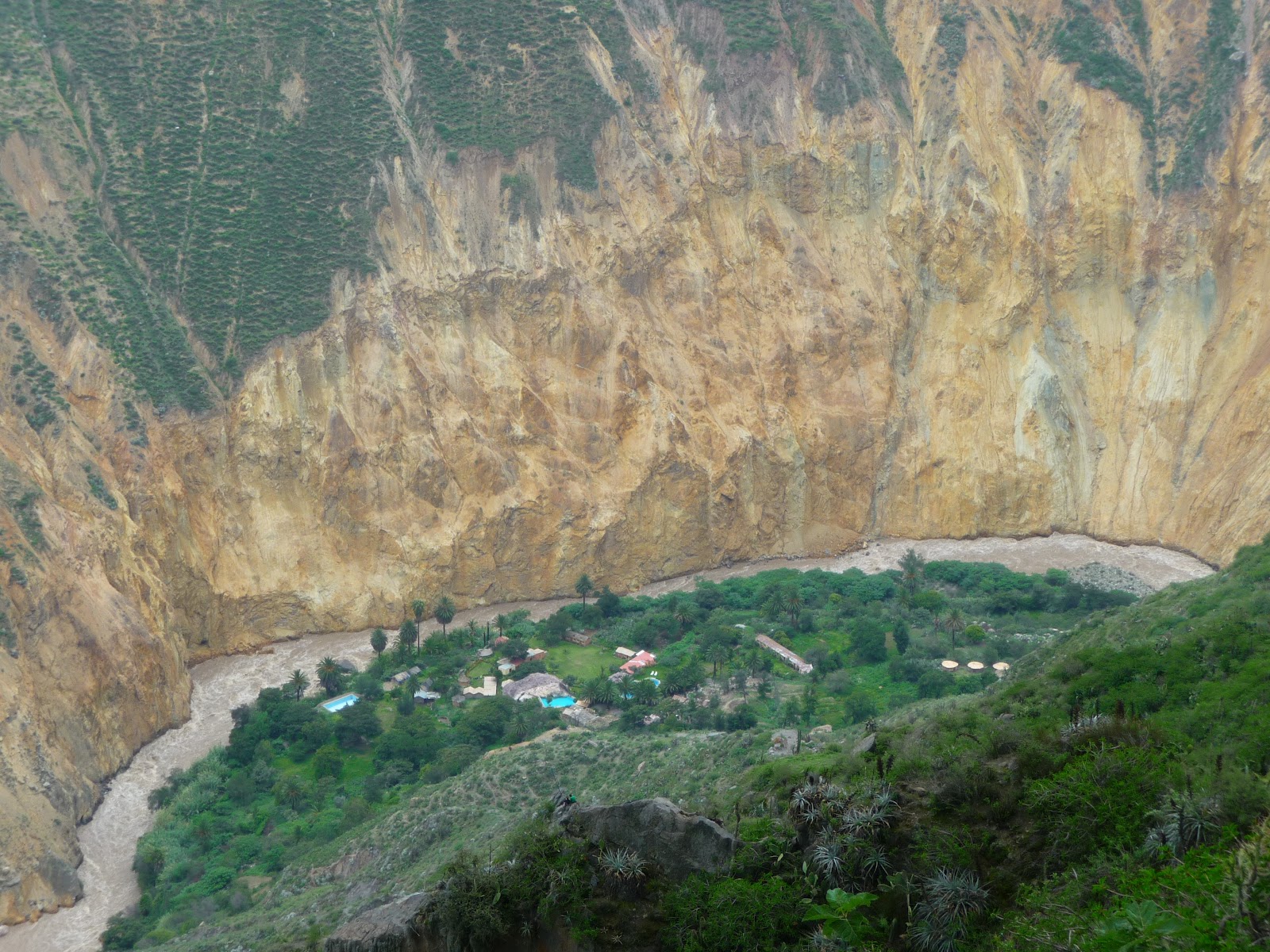
La mayoría de los turistas viene a Areuqipa para visitar el Cañon de Colca, una reserva natural muy bonito y, según unos datos científicos, el cañon más profundo del mundo.

Antes de entrar el cañon, paramos al Cruz del Condor, un sitio donde se puede ver condores pero como llegamos, habían demasiados nubes y así los condores no volaban (como no son tontos, jeje).

Vista en el valle nublado desde el Cruz del Condor
Después de llegar a Cabanaconde (el último pueblo accessible en coche), hicimos un trek en el cañon y bajamos un poco más de 1000 metros de altura para llegar al pueblito hermoso de Sangalle. A este pueblo, solamente se puede ir a pie o en mula. Para los turistas que están demasiado cansados después de la bajada, hay muchas personas que ofrecen su servicio de mulas para la montada - finalmente, la mitad de nuestro grupo aceptó esta manera de transporte para la vuelta :-)

Sangalle (abajo, al lado del río) - vista antes de la bajada

La vuelta en mula
La montada en la mañana siguiente era un poco fuerte, pero después de encontrar la velocidad perfecta (lo de un mula), no era tan pesado.

Desde aquí, voy a seguir para Cuzco para ver Machu Picchu y el resto.
-------------------------------------------------------------------------------------------------------------
Before starting this post, I have a technical announcement: I had problems with my SD card (for the camera) and with my USB stick. Actually, both got infected by a virus and it took me almost a whole day to get rid of the bastard - on the top of that, I was really worried that I could lose all my photos (as the USB stick is the backup for the SD card). After this experience, I decided that I'll never ever use public computers for my tools to avoid any reoccurence of such situtations. Because of all this, you'll see photos which are not taken by me but which are identical to the ones which I have taken.

After the coast, the earthquake and another night bus ride, I arrived to Arequipa last Tuesday together with some fellow travellers who I got to know in Lima and with whom we formed a very fun group.

Arequipa is the seconde biggest city of Peru and it's also called as "the white city". The reason for that is the colour of the buildings is mainly white due to the volcanic stone of the region used at the constructions. To me, Arequipa seemed a very beautiful and organized city, the historic center is very clean and well maintained.

Normally, the cathedral of Arequipa has a very nice view as one can see the El Misti volcano dominating the scene between the cathedral's two towers. Since it's the rainy season, we did not have the luck seeing it like that, but the building in itself is already pretty much astonishing.

The majority of tourists come to Arequipa to visit the Colca Canyon, a wonderful natural reserve which is also, according to certain scientific data, the deepest canyon of the world.

Before entering the canyon, we stopped at the Cruz del Condor, a place where one can observe condors flying. Unfortunately, by the time we arrived, the valley was too cloudy so we could not see them (as they are not stupid enough to fly in low visibility, lol).

After reaching Cabanaconde (the last village accesible by road), we did a trek down to the canyon. We descended some 1000 meters to arrive to a small village called Sangalle. This place is only accessible by two means: on your own feet, or on the back of a mule. For the tourists who are too tired after the descent, there are plenty of persons offering their mules for the uphill struggle - in the end, half of our group decided to go for that option for going back up.

The ascent next morning was indeed a bit tough, but after finding the appropriate speed (the one of a mule), it was not that bad.

The next stop will be Cuzco to see Machu Picchu and all the rest.

Thursday, February 2, 2012

Paracas, Huacachina y el seísmo / Paracas, Huacachina and the earthquake

--- for English, scroll down ---


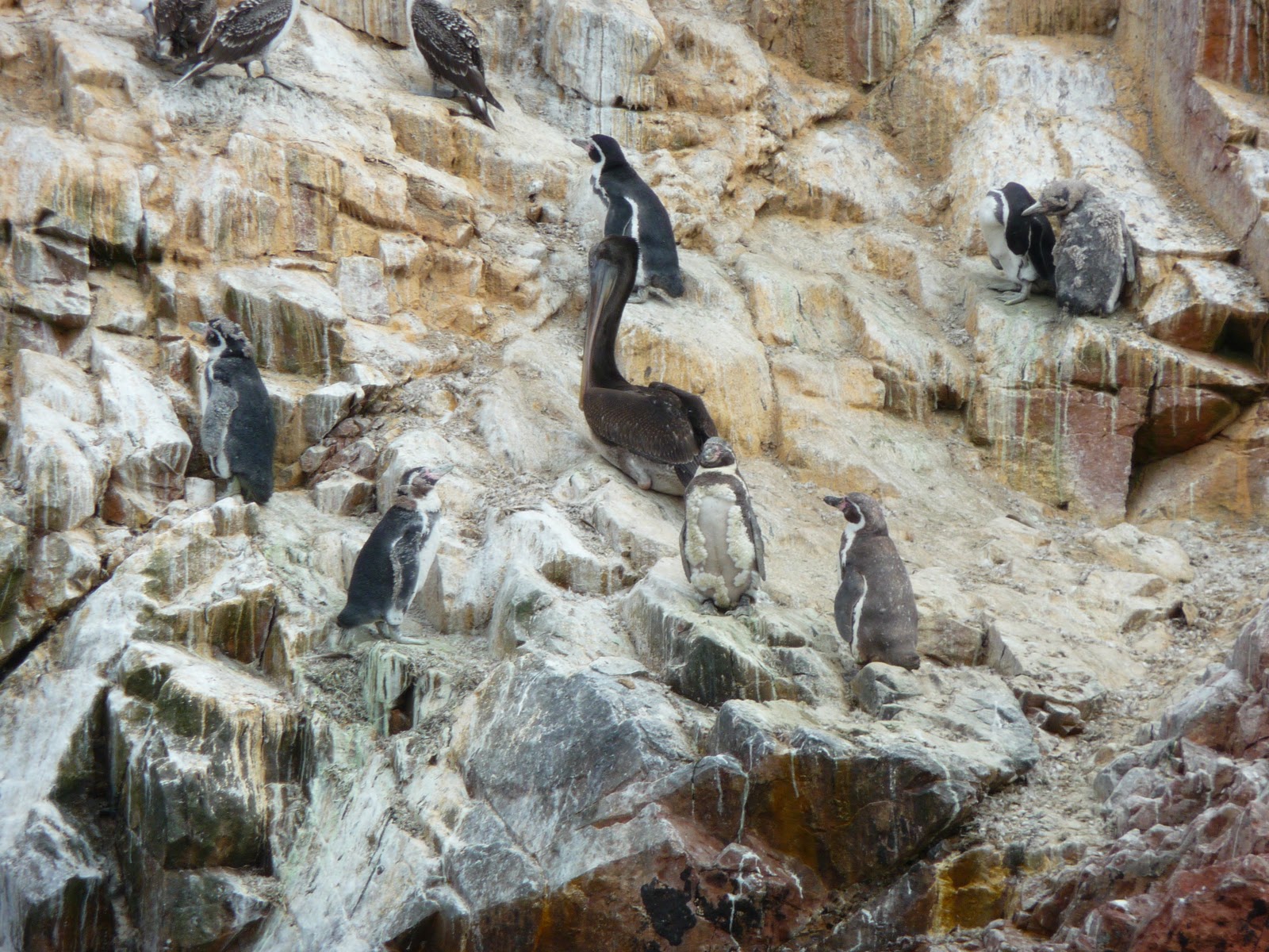
En la costa peruana cerca de Lima, hay muchas cosas para hacer. Paracas es el puerto de donde salen las visitas a Islas Ballestas, el lugar que unos libros guías se llaman "el Galápagos de los pobres".


Aunque no pienso que tenga la misma sensación que Galápagos, Islas Ballestas es un lugar que realmente vale la pena para visitar. Hay una enorme cantidad de pájaros (pelícanos, pingüinos, cormoranes, gaviotas, etc.) y con ellos, también viene un olor bastante interesante... La minería del guano ha tenido lugar en las islas desde hace muchas décadas y en algún momento, formó una parte muy importante del ingreso nacional de Perú.


Respecto al mamíferos, hemos visto hordas de lobos del mar. Son focas bastante grandes que vienen a las islas en su época de reproducción y cuando no hacen crías, su pasatiempo favorito es acostarse perezosamente en las rocas.


¡Que rodeemos el pelícano!

Pájaros, pájaros y más pájaros

Un lobo del mar haciendo su pasatiempo favorito

Desde aquí viene el guano
Mi alojamiento era en Huacachina, otro lugar interesante en esta región. Huacachina está conocido por sus dunas y la actividad principal de los turistas es ir en buggy a las dunas para hacer sandboarding. El viaje del buggy fue muy divertido y realmente como una montaña rusa como nuestro chófer hizo muchos saltos entre las dunas. Es una pena que parece que no tienen mucho cuidado para mantener este lugar limpio - había bastante basura en la arena...


Durante la noche, tenía mi primera experiencia personal de un seísmo. Como ocurrió unos minutos después de medianoche, estábamos durmiendo y en los primeros segundos, pensamos que todavía estamos soñando... Nos asustamos muchísimo y corrimos al patio del hotel y finalmente pasamos la noche por allí abajo de las estrellas en el estilo woodstock. Según las noticias, tenía una magnitud de 6,3 y parece que estábamos justo en el epicentro: http://noticias.aollatino.com/2012/01/30/peru-sismo-costas/

Buggy en las dunas de Huacachina

Las dunas

El oasis de Huacachina
Nuestro nuevo amigo llegando al restaurante
Mañana de Woodstock después del seísmo
Desde aquí, la siguiente parada va a ser Arequipa con los cañones y las montañas del sur.
-------------------------------------------------------------------------------------------------------------

On the Peruvian coast close to Lima, there's a lot to do. Paracas is the port from where boats are going to Islas Ballestas, the place to which many guidebooks refer as "the Galápagos of the poor".


Although I don't really believe that it lives up to Galápagos, the Ballestas Islands definitely worth the effort for a visit. There's an enormous amount of birds like pelicans, pinguins, cormorans, seagulls, etc. and with them, a pretty interesting smell is also present... Guano mining has taken place already for long and there was a time when this was one of the main sources of income of Peru at national level.


In terms of mammals, we have seen hordes of sea wolves. They are big seals who are coming to the islands in their period of breeding and when they're not producing their offspring, their favourite activity is to lay lazily on the rocks.


My hostel was in Huacachina, another interesting place in this region. Huacachina is known for its dunes and the main tourist activity here is to go on a buggy ride in the dunes and do some sandboarding. This was a lot of fun and pretty much like a rollercoaster as our driver did several jumps and crazy manouvers between the dunes. It's very unfortunate though that they don't seem to pay much respect for the environment - there was plenty of garbage buried partially in the sand...


During the night, I had my first personal experience of an earthquake. Since it happened just a few minutes after midnight, almost everyone was sleeping by that time and in the first seconds, we thought that we're still dreaming... It was pretty frightening and everyone ran out of the rooms to the courtyard where we finally passed the night in woodstock style. The day after we learnt from the news that it was a 6,3 quake and it seems that we were right in the epicenter of it: http://www.foxnews.com/world/2012/01/30/magnitude-63-earthquake-shakes-peru/?test=latestnews


The next stop will be Arequipa, some 1000 km further to the south, to see the canyons and the mountains.

Tuesday, January 31, 2012

Lima

--- for English, scroll down ---

Llegué a Lima en avión de Iquitos el jueves por la tarde. Durante mi vuelo, leía mi guía de viaje y la información de eso me aterrorizaba mucho. Según eso, Lima parecía la ciudad más peligrosa del mundo.

Aunque no intento a decir que no hay ninguonos riesgos por aquí (claro que hay, muchos, como en todas las ciudades grandes en todo el mundo), para mí Lima fue una sorpresa muy positiva.

Parque de la Exposición
Lima es una ciudad de diferencias enormes. Aunque en los barrios de chabolas, la pobreza extrema es la realidad, Centro Lima parece una ciudad extremamente bien mantenida. La arquitectura está mejor preservada que en muchísimas ciudades europeos.

Durante el día, no hay ningún problema con la seguridad, la presencia de la policía es fuerte y los lugares que están normalmente visitados por los turistas, eso es verdad durante la noche también. Parece que la municipalidad hace muchos esfuerzos para defender la industria turística.

Como no tenía mucho tiempo, solamente dí una vuelta en Centro Lima y en Miraflores - el segundo es un barrio muy moderno que parece a una ciudad americana.

La catedral de Lima

Palacio del Gobierno (anterior Casa de Pizarro)

Edifico colonial
Parece Miami? Es la Avenida de Arequipa en Lima!


Desde aquí, voy a ir al sur para Paracas e Ica.
-------------------------------------------------------------------------------------------------------------

I arrived to Lima from Iquitos by plane on Thursday afternoon. During my flight, I was reading my guidebook and the information provided there was quite horrifying as by that, Lima appeared to be the most dangerous city on Earth.

While I don't want to say that there are no risks whatsoever (of course there are, a lot of them, like in every big city), Lima was a real positive surprise for me.

Lima is a city of massive differences. Although extreme poverty is the reality in the shantytowns, Centro Lima is a very well maintained city and the architecture is much better preserved than in a number of European cities.

During the day, there is no problem with security, police presence is very string and at places which are normally visited by tourists, this is true for the night, too. It seems that the city does a lot of effort to defend the tourist industry.

Since I didn't have a lot of time, I could only make a walk in Centro Lima and in Miraflores - the latter is a neighbourhood which looks more like an American city than a Latin American one.

From here, I will continue towards the south and head to Paracas and Ica.

Thursday, January 26, 2012

Iquitos

--- for English, scroll down ---

--- NOTICIAS: fotos nuevas en el post anterior "La selva es así" / NEWS: new pictures uploaded to the previous post "The jungle as it is" ---

Mi primera idea era llegar en avión desde Colombia a Perú, pero finalmente lo cambié y decidí que voy a eligir otra forma de transporte: fluvial.

En Leticia (técnicamente, en Santa Rosa, una isla peruana en el Amazonas), se puede embarcar en barcos rápidos y cruzar la frontera en estos y llegar a Iquitos en más o menos diez horas. Para nosotros, el viaje tardaba casí doce horas porque bastantes veces se llovía a cántaros.

En el barco "rápido"
Llegué a Iquitos el martes por la tarde. Es la capital de la región amazónica (departamento Loreto) de Perú y probablemente una de la las cuidades más ruidosas del mundo. La razón para eso es la omnipresencia de los mototaxis (vehículos creado con la parte delantera y el motor de una motocicleta lineal pegados a un carrito de dos ruedas) que están circulando en hordas.

Mototaxis en el centro de Iquitos
Iquitos es el lugar en Perú para empezar descubrir fauna y flora selvática. El miércoles fui a un refugio que se llama Quistocoche y es un proyecto para salvar especies en vía de extinción. En este lugar se ve todos tipos de animales que se encuentran en la selva - ellos nacen aquí pero después lo preparan para volver a la selva y finalmente los liberan. Es muy importante proteger estos especies así porque en la selva, la gente todavía come todos tipos de animales - tortugas, caimanes, anacondas, incluso jaguares... Desafortunadamente, lo vi con mis propios ojos en el mercado de Belén donde lleguen todos los productos alimentarios de la selva.

Jaguar - el rey de la selva amazónica

Iguana

Guacamayo azul y amarillo (Ara ararauna)

Capibaras (conejos de la selva)

Delfín rosado
Ahora estoy en Lima y en unos días empezaré la parte montañosa de mi viaje.
-------------------------------------------------------------------------------------------------------------
At first, I was thinking about arriving by air from Colombia to Peru, but in the end, I decided to choose another mode of transport: the river Amazon itself.

From Leticia (technically, in Santa Rosa, a peruvian island in the Amazon), one can take a speed boat and cross the border with those, arriving to Iquitos in more or less ten hours. For us, the trip took almost twelve hours basically because it was pouring down like hell a number of times.

I arrived to Iquitos on Tuesday afternoon. It is the capital city of the Amazonian region (Loreto department) of Peru and probably one of the noisiest cities in the world. The reason for that is the omnipresence of mototaxis (vehicles created from the front part of a motorbike and a two-wheeled carriage) which are circulating in hordes.

Iquitos is the starting point in Peru for discovering jungle wildlife. On Wednesday, I went to a place called Quistocoche where they´re carrying out a project for endangered species. One can see all types of animals here which can be found in the jungle - they are born and raised here and after a certain time, they are being prepared for the re-introduction to their natural environment. It´s very important to protect these beasts of the jungle as they are still being hunted for their meat - turtles, kaymans, anacondas, even jaguars... Unfortunately, I have seen with my own eyes the ugly results of these surviving customs at the market of Belén where all food products from the jungle are shipped in.

Right now I´m in Lima and in a few days, I will begin the mountain part of my trip.

Monday, January 23, 2012

La selva es así / The jungle as it is

--- for English, scroll down ---


Normalmente, la gente piensa que el infierno es rojo con muchísimo fuego, el diablo cocinando los pecadores en calderas enormes, y tal. En realidad, la gente no tiene razón. El infierno tiene otro color. Verde.

Aquí se ve la selva. Lo que no se ve: la humedad, los insectos y el olor
Acabo de llegar a Leticia después de un viaje de tres días en la selva. Fueron unos de los días más duros en mi vida. Para empezar, la selva es muy cerrada, no hay ningún movimiento del aire entonces respirar ya es un esfuerzo y no importa que estás haciendo, sudas como un caballo. Pero bueno, la selva es así.

Cuando llueve, llueve a cántaros y las hojas de los árboles no son tan espesos que pueden protegerte - tienes que prepararte para mojarse completamente. Si te mojas una vez, no vas a secarte nunca más. Pero bueno, la selva es así.

Un serpiente venenoso esperando a su presa

Rana

Nuestro refugio, hecho por nosotros mismos
 
Un aligator bebé
El suelo no es realmente un suelo, es una mezcla de barro y partes podridas de la vegetación. Es totalmente obligatorio ir en botas de goma y no es raro si te hundes hasta tus rodillas en esta sopa. Pero bueno, la selva es así.

En la selva, todo está pudriéndose. Si dejas una manzana allí, va a desaparecer en un día completamente. En la selva, tu estás pudriéndote también. Pero bueno, la selva es así.

Y los insectos. Ya sabía antes que más que 90% de la fauna mondial son insectos, pero la variedad y la hostilidad de estas creaturas en la selva es impresionante. Abejas, hormigas, escarabajos, langostas y no olvidamos de nuestros amigos los mosquitos. Ellos nunca, nunca van a dejarte en paz. Es mejor seguir caminando porque en el momento cuando paras, seguro que van a venir nubes. Pero bueno, la selva es así.
 
Desafortunadamente, ahora no puedo cargar más fotos porque la conección de internet es tan terriblemente lenta que la cargada de esto de arriba me tardaba más de diez minutos. Voy a cargar unas más cuando tenga una conección tolerable.

Esa experiencia fue muy buena para que comprenda mejor las películas como Apocalypse now, La Playa y The Pacific. Y para los que piensan que soy demasiado débil (que puede ser verdad, jeje), os recomendo una vuelta en la selva amazónica ;-)
---------------------------------------------------------------------------------------------------------------
Normally, people think that the color of hell is red with lots of fire, the devil cooking the sinners in big pots and so on. They are wrong. In reality, hell has another color. Green.

Captions under pictures:

- This is how the jungle seems on a picture. What does not show up, is the humidity, the insects and the odours
- A venomous snake waiting for its prey
- Frog
- Our refugee hut, made by ourselves
-  A baby aligator

I'm just back from a 3-day jungle trek which I would easily put as one of the phisically toughest days of my life. To start with, the jungle is very closed, the air is still and there is no movement whatsoever so even breathing takes an effort and you're sweating like hell even if you're not doing anything. But ok, the jungle is like that.

When it rains, it rains cats and dogs and the canopy is not thick enough to protect you so you have to prepare yourself for getting completely soaked. Once you get wet, you will never ever get dry. But ok, the jungle is like that.

The soil is not really soil, it's a mix of mud and rottening pieces of random vegetation. It's absolutely mandatory to go in wellingtons as it's not uncommon that you're sinking until your knees in this swamp. But ok, the jungle is like that.

In the jungle, everything is constantly rotting. If you leave an apple there, in a day it would be completely gone. In the jungle, you're rotting as well. But ok, the jungle is like that.

And the insects. I knew before that more than 90% of the world's fauna are insects, but the variety and the hostility of these creatures in the jungle is still impressive. Bees, ants, scarabs, locusts, and not to forget about our good friends: mosquitos. These guys will never ever leave you alone. It's better just to keep on walking because at the very moment you stop, they will come in clouds. But ok, the jungle is like that.

Unfortunately, right now I cannot upload more photos as the internet connection here is so painfully slow that uploading the above picture took me more than 10 minutes. I will upload some more once I will have a tolerable level of service.

This experience was very good to understand better movies like Apocalypse now, The Beach and The Pacific. For the ones who might think that I'm just simply too weak (which might be right, lol), I recommend you a tour in the Amazonian rainforest ;-)

Wednesday, January 18, 2012

Santa Marta / Taganga / Tayrona

--- for English, scroll down ---

Desde Cartagena, es muy fácil llegar a las playas super bonitas de la región de Santa Marta y el PNN (Parque Nacional Natural) Tayrona. Como es alta temporada en América del Sur, todo está completamente lleno de turistas y parece que la mitad de Argentina está aquí para las vacaciones.

El centro de la región es Santa Marta, una ciudad con bastante comercio, turismo y un puerto. Desde el parque del puerto, frecuentemente pasan las chivas (autobuses típicos de Colombia, Ecuador y Panamá adaptados en forma artesanal para el transporte público rural, que ahora utilizan para traer los turistas a las playas).

Una de las iglesias de Santa Marta

Chiva en Santa Marta

El puerto de Santa Marta
Una de las destinaciones más populares es Taganga, un pueblo de pescadores que está muy cerca a Santa Marta, algo como diez minutos en autobús (no en chiva, jejeje). Es donde me quedaba durante dos noches.

Vista del pueblo Taganga
Una de las atracciones más populares en esta región es el PNN Tayrona, que es una red de playas protegidas con arrecifes naturales. Se encuentra a 34 km de Santa Marta y es uno de los parques naturales más importantes de Colombia. Es hábitat de una gran cantidad de especies que se distribuyen en regiones con diferentes pisos térmicos que van desde el nivel del mar hasta alturas de 900 m. El parque tiene no menos que 15.000 hectáreas.


Está prohibido utilizar vehículos motorizados adentro del parque y toda la comida y cosas así lleguen únicamente en caballo.

Cabo de San Juan en PNN Tayrona

Cosas llegando a Tayrona
Ahora estoy en Cartagena otra vez y mi vuelo sale en unos momentos a Bogotá y mañana voy a ir a Leticia en la selva amazónica.
-------------------------------------------------------------------------------------------------------------

From Cartagena, it's very easy to arrive to the wonderful beaches of the region of Santa Marta and the PNN (National Natural Reserve) Tayrona. Since it's holiday time in South America, everything is completely full of tourists and it seems that the half of Argentina is around here spending their vacations in Colombia.

The region's center is Santa Marta, a city with quite a lot of business, tourism and a port. From the parking of the port, the chivas (typical buses in Colombia, Ecuador, Panama prepared in an artistic way for rural transport which are currently used for transporting tourists to the beaches) are running quite frequently.

One of the most popular destinations in Taganga, a fishermen's village which is only about ten minutes by bus from Santa Marta (not by chiva, lol). This is the place where is spent two nights.

One of the main attractions here is PNN Tayrona, a network of protected beaches and natural reefs. It's 34 kilometers from Santa Marta and it's one of the most important natural parks in Colombia. It's habitat for a large number of species which are distibuted within different elevations from sea level up to 900 m. The park has no less than 15.000 hectars.


The use of motorized vehicles is forbidden in the whole park and food and other supplies can only arrive on horses and mules.


Now I'm Cartagena again, waiting for my flight to leave for Bogotá and tomorrow I'm going to Leticia in the Amazonian rainforest.

Monday, January 16, 2012

Cartagena

--- for English, scroll down ---

Pues, como he dicho antes, el viaje para Cartagena desde Medellín fue otra vez una cosa memorable que tardaba 13 horas. A lo mejor, podía dormir durante la mayoría del viaje.


Cartagena es probablemente el lugar más turístico que podemos encontrar en Colombia. Andando en el casco histórico, podemos sentirnos como si fueramos en una ciudad en Andalucía, el ámbito colonial es tan presente.

El casco histórico de Cartagena

La puerta y Las Murallas de la ciudad vieja
Estatua de Pedro de Heredia, fundador de Cartagena
El torre de la Catedral de Cartagena
Un punto para marcar: la mayoría de estos edificios fueron construido de coral, incluido el catedral y Las Murallas de la ciudad vieja... Así destruyeron los arrecifes que fueron cerca de la ciudad. ¡Que verguenza!

También existe otra Cartagena, un lugar muy pijo que se llama Bocagrande. Eso es el nuevo centro de apartamentos bonitos y playas con arena blanca. He dado una vuelta por allí el domingo por la mañana, antes de salir para Taganga, cerca del Parque Nacional Tayrona.

Bocagrande, vista de Las Murallas

Bocagrande y su playa

Punto de salvavidas en la playa de Bocagrande
Ahora el plan es quedar aquí hasta mañana, y después volver al oeste por Barranquilla (o Cartagena otra vez). El miércoles mi avión sale para Bogotá y el jueves para Leticia en la selva amazónica. Espero que sea chulo.
-------------------------------------------------------------------------------------------------------------
So, as said in the previous post, the trip from Medellín to Cartagena was quite a memorable event with its 13 hours - at least I could get some sleep on the bus during most of it.

Cartagena is probably as touristic as anything in Colombia can get. Walking in the old town, one can feel like being in one of the cities of Andalucía due to the heavy presence of the colonial environment.

One point to make though is that the most of these buildings were built using corals, including the cathedral and the old city´s walls themselves... Like this, they managed to destroy most of the reefs close to the city. Good job, guys.

Apart from the historical center, another Cartagena was born not so long ago called Bocagrande. This is the new center for posh apartments and nice white-sand beaches. I made a short walk in this part on Sunday morning before heading out to Taganga, close to the Tayrona National Park.

Now the plan is to stay here until tomorrow and then head back to the west via Barranquilla (or Cartagena once more). On Wednesday, I´ll have my flight back to Bogotá and on Thursday, to Leticia, well into the amazonian rainforest. I hope it´s gonna be fun.